GIS Consulting Services

Gain Insightful Predictions and Analyze Trends for Better Decision-Making

Unlock the Power of Geographic Data 

At Config Nepal, we offer a range of GIS (geographic information system) services to help businesses make informed decisions using spatial and geographic data. Our team of experienced engineers is skilled in providing consulting and GIS software development services, including accurate positioning and spatial data management. We can help you capture, sort, and interpret data that is critical to your business, and present it on custom or commonly used interactive maps.

A well-built GIS allows companies to uncover actionable insights from location data, map layers, and 3D modeling. By recognizing geographical patterns and trends, businesses can make more informed decisions and drive growth. Our GIS services can help you get the most out of your location data and make data-driven decisions that benefit your business.

Contact Config Nepal to learn more about how our GIS services can help your business succeed. Whether you need help with a specific project or want to learn more about how GIS can benefit your business, we are here to help.

GIS Consulting Services

Data Digitization and Management

At Config Nepal, we offer data digitization and management services to help businesses convert their information into a digital format and organize it in a way that makes it easy to access and share. Our team has the skills and expertise to handle a wide range of data digitization projects, and we work closely with our clients to ensure that their data is accurately converted and organized. Contact us to learn more about how our data digitization and management services can benefit your business.


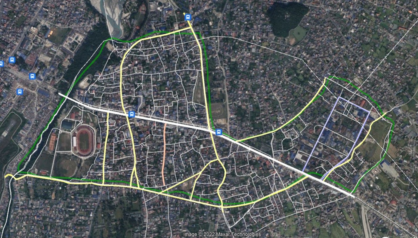
GIS Map Production (2D/3D)
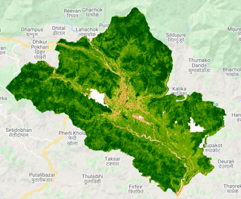
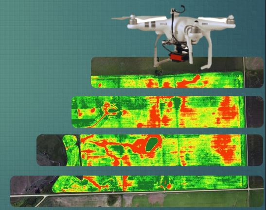
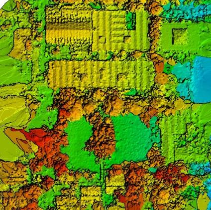
At Config Nepal, we offer 2D/3D GIS map production services to help businesses better understand and analyze their geographic data. Our team has the skills and expertise to create high-quality maps that can aid in the interpretation of map features and their concentration or distribution in relation to a particular area or range. Contact us to learn more about how our 2D/3D GIS map production services can benefit your business.

Satellite Imagery 
Analysis

At Config Nepal, we offer satellite imagery analysis services to help businesses gain insights from satellite pictures for earth observation, boundary mapping of natural resources, land use, and environmental monitoring. We provide a clear, concise, and accurate representation of how events are unfolding, using advanced analysis techniques to extract valuable information from satellite images.

Surveying and Data Collection

At Config Nepal, we offer surveying and data collection services to help businesses gather the necessary dimensions and spatial data needed to determine the relative position of points or physical features. We use the latest technology and tools to ensure accurate and efficient data collection and mapping solutions.

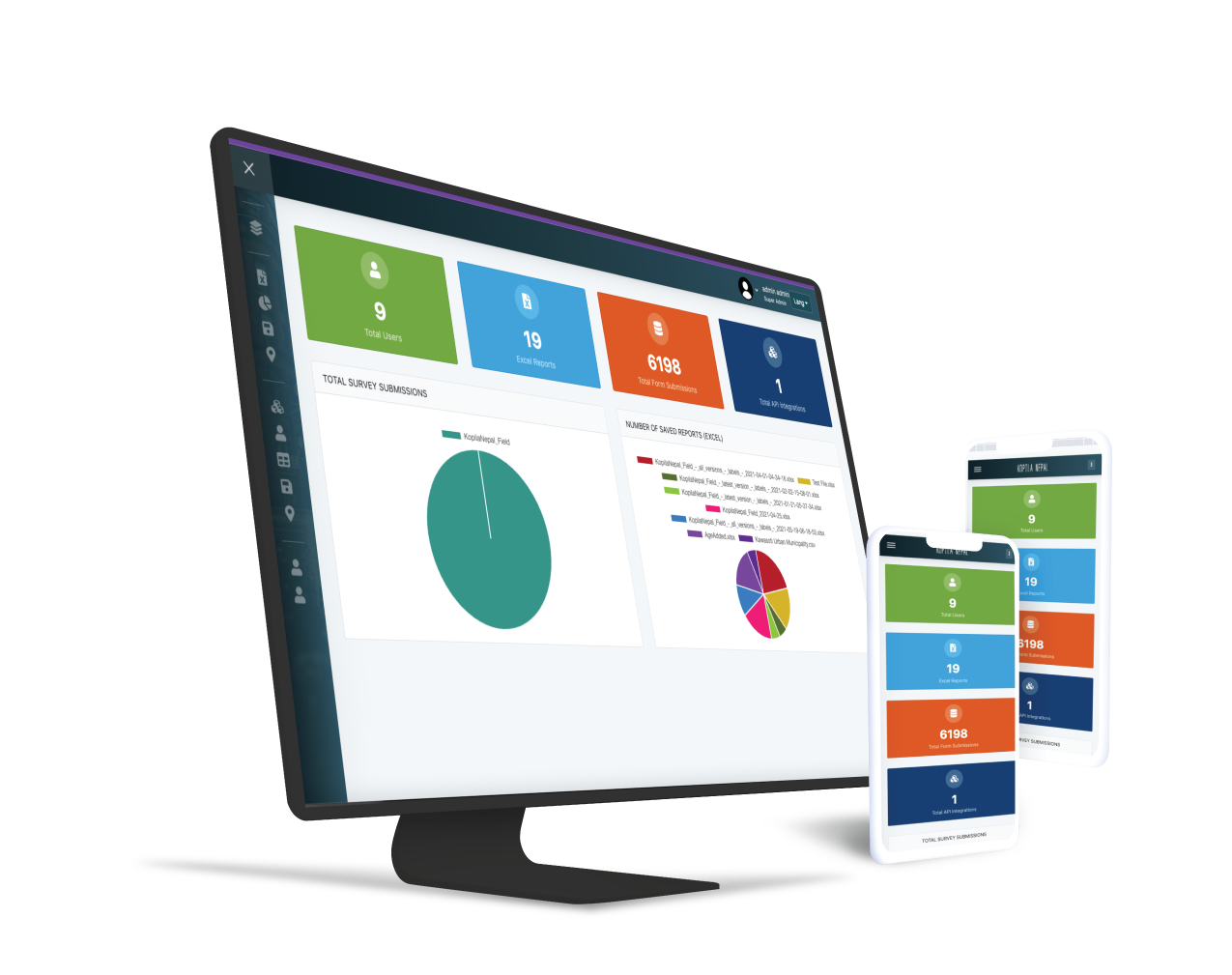
Web-GIS and App Development

GIS applications can be used for a variety of purposes, including data collection, access to GIS tools, and the creation of custom maps. With our GIS web and app development services, you can create a solution that meets your unique requirements and helps you get the most out of your geographic data.

GIS Modeling and Analytics

At Config Nepal, we offer GIS modeling and analytics services to help businesses gather, manipulate, and display geographic data and imagery, including GPS and satellite images.  Geospatial analytics is a powerful tool for businesses looking to better understand and analyze geographic data. Whether you need to model trends in land use, predict changes in weather patterns, or analyze customer behavior, our GIS modeling and analytics services can help.

Benefits of GIS Mapping Services

Improve Data Management

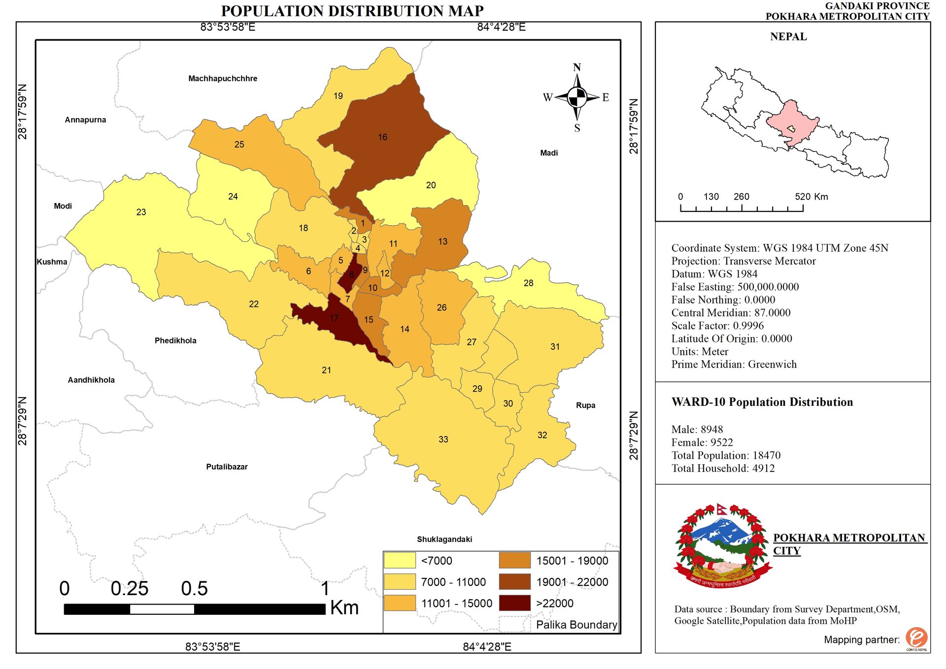
GIS mapping services can help companies to store, manage, and analyze their spatial data in a more efficient and organized way. This can improve data accuracy and make it easier for companies to use this data in their operations.

Enhanced Visualization and Analysis

GIS mapping services allow companies to visualize and analyze their data in a spatial context, which can help them to identify trends, patterns, and relationships that might not be obvious in other forms of data.

Increase Efficiency

GIS mapping services can help companies to automate processes and make them more efficient. For example, a company might use GIS mapping to optimize delivery routes or to track the movement of assets.

Enhanced Decision Making

GIS mapping services can help companies to make more informed and data-driven decisions by providing a visual representation of data and allowing them to analyze trends and patterns in their operations. This can help companies to respond more quickly to changing market conditions and make better business decisions.